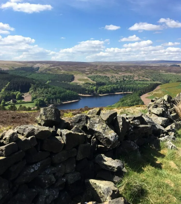
Rother Ramblers Peak District 2026 June 27th – July 4th
FULL PROGRAMME
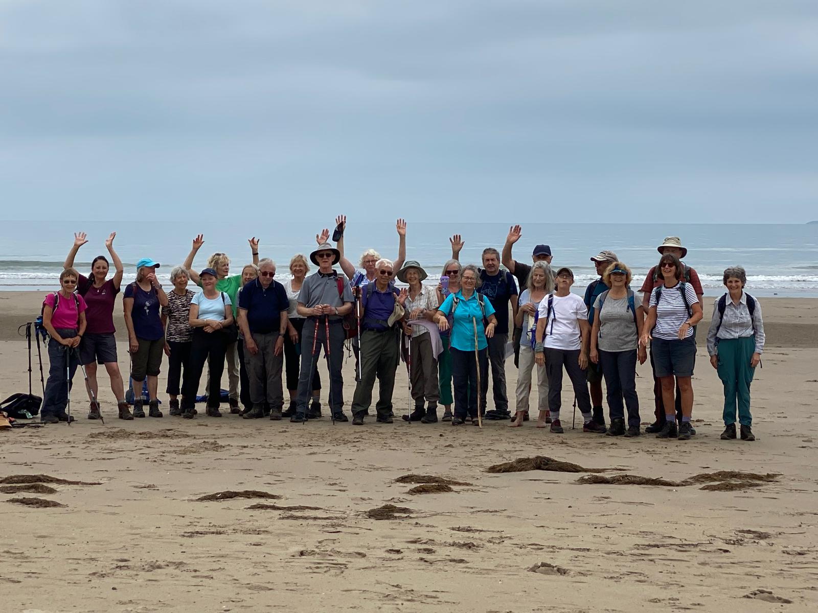
Harlech Beach – June 2025
Introduction:
Welcome to the latest Rother Ramblers walking trip. This year we will be venturing to the Peak District, Britain’s first national park which this year celebrates 75 years since it received its official designation. We will base ourselves in the largest town in the Peak District, Bakewell, famous for its tarts, (or should I say, puddings!) The National Park is really split in two, The White Peaks and The Dark Peaks. The two areas are very different, the White Peak with limestone ridges and dales, the Dark Peak is a bleaker, more barren wilderness. The walks programme should have something for everyone with plenty of variety, leisurely to moderate and the occasional strenuous route. We will explore several picturesque dales, walk through some upland villages, gritstone edges, hills or Tor’s as they are called in this part of the world, woodland, cross rivers using stepping stones and visit places of interest. I do not intend to recce any of the routes beforehand, this has not proved to be a problem in the past, the guidebooks are clear and the paths clearly marked. Fortunately, we have several members who know the area well and have volunteered to lead some of the walks.
The programme covers 7 days allowing everyone to have a break from walking and explore the many places of interest the area has to offer. There is no pressure on anyone to do all the walks or, to stay for a full week, the arrangement is totally flexible. As always, the social side is just as important as the walking and there will be plenty of opportunities for us to get together.
If anyone is interested in participating in this trip or would like further information, please contact me. Let’s hope our good fortune with the weather continues, I hope you are looking forward as much as I am. Wil Morris
Accommodation:
Everyone is responsible for sourcing and arranging their own accommodation. There are several hotels, B&Bs, holiday lets, Airbnb’s, hostels, campsites etc in Bakewell or its nearby villages. Please discuss with your friends and book early!
Travelling:
There are numerous routes to our destination and it’s up to individuals to decide which is best for them. Travelling by train is an option but isn’t easy and anyone choosing this option would be reliant on the availability of lifts to the walk starting points. We have not experienced any issues with car-sharing in the past and there is nothing to suggest that it won’t work on this occasion. Please make own arrangements for transport, if anyone requires assistance, please let me know.
General information:
- Car sharing is the easiest method of getting to the start points and has worked well on our previous trips. Some of the starting points are accessible by bus, but the timetables may not match walk start/finish times. To achieve the full programme of walks and to allow time for sightseeing between walks, it is essential that everyone adheres to the timetable. Individuals are responsible for informing myself, ideally the day before, of the walks they wish to do. I will be keeping a list of participants on each walk. It may be necessary to amend start times as the situation requires, i.e. to align with the next walk etc.
- Well-behaved dogs are welcome but as this is sheep farming country, they will need to always be on leads around livestock.
- With everyone’s agreement, a WhatsApp group will be set up in advance of the trip to make it easier for individuals to contact other participants to arrange transport, accommodation etc.
- Map references, postal codes and what3words are provided for all the walk starts and individuals are responsible for finding their own way to the start of the walks. Due to the remoteness of some of the start points, the postcode given may not always provide pin-point accuracy. I would encourage everyone to download the What3Words app as it is the most reliable.
- If anyone is uncertain and wishes to follow someone else, please make own arrangements.
- Some walks are quite local to Bakewell and will involve minimal travelling time. However, some walks will involve 30 – 60 minutes travelling time to reach the start point.
- The walks programme may be changed to accommodate any unforeseen circumstances such as poor/extreme hot weather conditions etc.
- All the walks are on maps OS Explorer OL24 White Peak Area or OL1 Dark Peak Area. There is no need to purchase a map as copies of the walk routes will be available to the group.
- Car parking in most cases will require payment. There are public toilets available at the start and/or on route on many of the walks. Alternatively, free parking may be available at the roadside in some of the villages, but please always park considerately. If you are a National Trust member, please bring your card with you just in case. I would recommend carrying cash just in case the parking meters don’t accept bank cards etc.
- I have several guidebooks, maps, and self-led routes available to anyone who may wish to walk outside of the group.
- Some of the longer walks are quite strenuous with several relatively steep ascents/descents – speak to me if you have any doubts; only attempt them if you are fit and confident to do so.
- I will print copies of this year’s programme and distribute them at the start of the first walk.
- There should be opportunities for everyone to explore some of the towns and villages en-route and visit places of interest.
Walks Programme:
Saturday 27th June:
Ashford Lake from Bakewell, - 5.5 miles. Start: 16.00
Meeting Point – Holme Packhorse Bridge off Ashford Road
OS Explorer: OL24: SK215689
Postcode: None available
What3words – realm.laser.plank
An introduction to the area and an opportunity to congregate after travelling from the South-East. Meet by the ancient Holme Packhorse Bridge which was built in 1664. The walk explores the countryside to the north of the town and the route uses well marked paths many of which were originally packhorse ways, believed to be some of the oldest in the Peaks. The route includes a short section of the Monsal Trail, originally part of the Midland Railway that ran from London to Manchester. We return via Ashford-in-the-Water and its nearby lake.
***********************************************
Sunday June 28th:
Youlgreave & Lathkill Dale – 8.0 miles. Start: 09.30
Meeting Point – Roadside parking within the village, meet by All Saints Church, Youlgreave
OS Explorer OL24:
Postcode: DE45 1WN
What3words – grower.spearhead.tribune
Historically, the village of Youlgreave was associated with lead mining, the nearby rivers providing water to power both corn and lead crushing mills. The walk explores Bradford, Cales and Lathkill Dales, the former was once the scene of intensive activity now it has been transformed into a tranquil and natural valley with little remaining of its industrial past. The route follows rivers, crosses woodland and open pasture, with some fine views across the limestone plateau.
Middleton & Long Dale – 6.0 miles. Start: 14.00
Meeting Point – Car parking in Middleton-by-Youlgreave. Meet by the RAF Wellington BJ652 Memorial.
OS Explorer OL24: SK195632
Postcode: DE4 4LU
What3words – typed.tests.recruiter
Just a short distance from our earlier walk, this walk takes us through two little-known, peaceful Dales. We will have walked a section of Bradford Dale earlier, following the river Bradford as it meanders towards Youlgreave. Long Dale is a complete contrast as it is dry. Our route follows ancient sunken tracks offering wide-ranging views over the surrounding countryside. Although a quiet village these days, in earlier times Middleton has seen a lot of activity; it once had a castle and during the English Civil War a bloody battle took place. On our way we will pass sculptures that were erected as a Millenium Project initiative. I don’t know more details, but they are supposed to highlight ‘Sites of Interest’. We shall see……
************************************************
Monday June 29th:
Chee Dale – 5.5 miles. Start: 09.30
Meeting Point – Pay Parking at the Old Platforms at Millers Dale Station
OS Explorer OL24: SK138732
Postcode: LL47 6TB
What3words – plus.quicksand.removers
This walk through the picturesque Chee Dale is often described as one of the most beautiful in the Peaks. Starting from the old platforms at Millers Dale Station we pick up the Monsal Trail, crossing an old viaduct before walking alongside the River Wye as it twists through the spectacular limestone gorges. The section through Chee Dale is quite spectacular, the gorge narrows at one point with the path resorting to stepping-stones! (an alternative route is available if the water is high). Leaving the gorge, we enter upland pasture offering fine panoramic views over the landscape. An old trackway takes us back to our starting point.
Chatsworth from Baslow – 7.5 miles. Start: 13.00
Meeting Point – Pay parking in Baslow village.
OS Explorer OL24: SK258721
Postcode: DE45 1SP
What3words – tailed.manage.rucksack
Chatsworth, the Derbyshire home of the Duke and Duchess of Devonshire, is one of the most-visited stately homes in Britain. This relatively easy walk starts from the nearby estate village of Baslow. Most of the parkland and woods surrounding Chatsworth are free to roam and we will explore the grounds that were landscaped in the 1760s by the famous Lancelot ‘Capability’ Brown. We will visit Emperor Lake which was created to provide water (under natural pressure) to the spectacular Emperor Fountain, and we should get some wonderful views of the famous mansion. The route includes a visit to another estate village, Edensor, which was created by the 6th Duke of Devonshire between 1638 and 1842, because the original village spoilt his view from Chatsworth house! The church in Edensor has several memorials to the Devonshire family, and, more surprisingly, a plaque to remember Kathleen Kennedy, sister of President John F Kennedy who was killed in an aircraft crash nearby. From the village we will follow the River Derwent back to our start point.
************************************************
Tuesday 30th June:
Cave Dale & The Great Ridge – 9.5 miles. Start: 09.30
Meeting Point – Hope village car park, alternative parking at the roadside.
OS Explorer OL1: SK171835
Postcode: S33 6SB
What3words – gratuity.recur.shocks
This will be our first visit to the Dark Peak area of the National Park. We will notice a distinct change in the landscape; this area is more rugged compared to the previous gentler walks. The walk starts from the popular small town of Castleton, which has a castle built in 1080 by William Peveril, son of William the Conqueror. Our route takes us into Cave Dale before climbing to the highest point, Mam Tor where there is a dramatic change in landscape from limestone to gritstone and shale. Walking along the undulating grassy ridge known as Green Dragon’s Back we will visit a further two high points, Back Tor and the impressive Lose Hill. Another name for the summit of Lose Hill - Wards Piece - originated from the purchase of the summit area by the Sheffield Ramblers in 1945. The name is dedicated to their member GHB Ward who was a great advocate of rambling. It was handed over to the National Trust to preserve for everyone to enjoy and was one of the earliest forms of public access land. The ascents are relatively moderate, (not as difficult as Eryri) but are well worth the effort due to the fine panoramic views. Descending from the ridge, we pass through the pretty village of Hope before arriving back at our starting point.
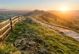 The Great Ridge
The Roystone Grange Trail – 4.0 miles. Start: 15.15
Meeting Point – Minninglow Car Park on the High Peak Trail, south of Pikehall on A5012 Cromford to Newhaven Road
OS Explorer OL24: SK194582
Postcode: DE4 2PN
What3words – falls.juicy.toffee
After our earlier more strenuous walk, this will be a gentle stroll along part of the High Peak trail which follows the route of a dismantled railway line. The line was originally designed as a canal to link Cromford Canal with the Peak Forest Canal at Whaley Bridge. The railway was completed in 1830 and was one of the earliest operational lines in Britain and before the introduction of locomotives, used horses to haul the coaches and freight wagons. Another unusual feature of the line was the Gotham Curve, where the line makes an 80-degree turn, the tightest on any British Railway Line. The Minninglow Neolithic Tomb on the summit of Minninglow Hill is another point of interest being one of the earliest prehistoric monuments in the Peak district. The area has been subjected to several excavations but most of the prehistoric material had been plundered, only Roman coins and pieces of Romano-British pottery were found. A more recent excavation carried out by Sheffield University has revealed continuous use of this remote valley since Roman times. Some of the drystone walls still in use today were first laid down in Roman times. An interesting walk along former railway track, field paths and quiet country lanes.
**************************************************
Wednesday 1st July:
Dovedale – 7.0 miles. Start: 09.30
Meeting Point: Dovedale car park near the village of Thorpe
OS Explorer OL24: SK146507
Postcode: DE6 2AY
What3words – hotspot.partly.gambles
Probably the most popular of all the dales in the Peak District, Dovedale has a lot to offer, ash woodland, caves, high limestone pinnacles and natural arches, and the beautiful River Dove with its famous stepping-stones. Difficult to imagine that the glaciated river created these rock formations, carving out this gorge during the Ice Age. Our route is easy walking on engineered paths, fields and quiet country lanes. There are some short sharp ascents, but nothing too strenuous. Some fine views and points of interest throughout, including Lovers Leap, Ilam Rock, Lion’s Head Rock, and the former packhorse-bridge now known as Viator’s Bridge.
Deepdale & the Magpie Mine – 5.0 miles. Start: 14.00
Parking: Pay parking beside A6
OS Explorer OL24: SK170705
Postcode: DE45 1NL
What3words – differ.bearable.rats
The walk starts from the banks of the River Wye, soon entering Deep Dale and then onto a limestone plateau and the small village of Sheldon. The area was heavily mined for lead and there are several reminders of this industrial past on our route. The Magpie Mine is probably the best-preserved lead mine in Britain and we will have time to explore some of the remaining buildings and running gear. The mine was worked from 1682 with only a few periods of inactivity for 300 years. The last unsuccessful attempt at mining took place in 1950. One of the many problems encountered was flooding which was resolved at Magpie by building the Magpie Sough, a 1-mile-long tunnel that drained the water into the River Wye. Achieving this cost in the region of £18k - £35k, a significant amount of money in 1881! There are some fine panoramic views from the mine site. We follow field paths to Sheldon and finish with a steep descent to our starting point.
**************************************************
 Ladybower Reservoir
Thursday 2nd July:
Ladybower Reservoir – 6.5 miles. Start: 09.30
Meeting Point – Heatherdene car park on A57 near Ashopton viaduct.
OS Explorer OL1: SK195864
Postcode: S33 0BY
What3words – wimp.matter.deflated
This is a walk that delivers some wonderful views and has several points of historical interest. The once idyllic valley was drowned in 1943, several farms and the villages of Derwent and Ashopton would be lost forever. We will learn more about the history of these lost villages during the walk. Another point of interest is the fact that the Derwent Dam was used by the famous Dam Busters crews, whilst training before the successful raids on the Mohne and Eder Dams during WW2. The walk starts with a moderate climb to Crook Hill (170m) before the terrain becomes much easier. There are 3 viewpoints on this section with some fabulous views towards the high points of Kinder Scout, Mam Tor and Win Hill as well as the Derwent Valley and Ladybower Reservoir, and towards the eastern skyline and its interestingly shaped rocky outcrops. The route follows well marked footpaths, ancient bridleways, returning along a small quiet country lane.
Stanage Edge from Hathersage – 7.0 miles. Start: 13.30
Meeting Point – Oddfellows Road car park, Hathersage. Alternative parking at the roadside.
OS Explorer OL1: SK231813
Postcode: S32 1DU
What3words – applause.cabbies.frown
Stanage Edge is one of the first names that comes to mind when visiting the Peak District. The walk starts from the busy and popular village of Hathersage where we will have an opportunity to grab a quick snack in one of the several cafés and pubs located within the village centre. In the 19th century, the village was home to a thriving needle, pin and wire-drawing industry. Many men were also employed on mill and grindstone making and the remains of their industry, in the form of abandoned mill stones is still evident beneath the rock faces of Stanage Edge. The legend of Robin Hood is strongly linked with Hathersage, the faithful lieutenant Little John is claimed to have been buried in the abnormally long ‘grave’ in the churchyard! The Eyre family lived locally and there are several monuments within the churchyard in memory of family members. Our route passes some fine houses including North Lees Hall thought to have been the model Charlotte Bronte used for Thornfield Hall in her novel Jane Eyre. Total ascent is 278m, mainly on field paths, tracks and lanes. The highlight being the gritstone escarpment of Stanage edge which is very popular with hang-gliders and climbers. If time allows, a slightly longer route which includes the high point of High Neb and Crow Chin may be considered.
 Stanage Edge
***************************************************
Friday 3rd July:
Three Dales & Water-Cum-Jolly – 7.5 miles. Start: 09.30
Meeting Point - Pay Parking at Tideswell Dale picnic site
OS Explorer OL24: SK153741
Postcode: SK17 8QH
What3words – text.wisdom.comedy
Our route starts from Tideswell Dale through an area once mined for brown dolerite, a mineral left by prehistoric volcano activity. Litton Mill will be a point of interest; this old textile mill was founded in 1782 and has a history of being run on slave labour of orphans and other unfortunates who fell into care of the ‘Guardians of the Poor’. We follow a quiet riverside path through Millers Dale soon entering the wonderfully named dale of Water-Cum-Jolly, the name itself attracts a visit! The old textile mill at Cressbrook was once powered by water and was originally built for the famous Richard Arkwright, an important figure during the industrial revolution. Cressbrook Dale contrasts from the others as it is more rugged with crags, rock formations and caves. One such crag known as Peter’s Stone is reputed to be haunted by the last man to hang from a gibbet on its summit. The village of Litton is a typical Peak District village with limestone cottages and a series of little greens. The walk offers great variety and apart from one steep 400m climb, it is relatively easy walking.